Great Head Trail

Great Head Trail is a heavily trafficked trail that is located north of Seal Harbor next to Sand Beach. It has great views of the coastline and many wooded sections of hiking. The Great Head Trail is rated a moderate difficulty.

Parking is at Great Head Trail Parking Area off of Schooler Head Road.

Loading...

Check out our archive page to see older versions of this TrailView!

Trail Stats

Length 1.5 mi
Difficulty Medium
Elevation Gain 350 ft
Elevation Loss 340 ft

Find trails similar to this one by clicking the options below:

Difficulty
Elevation Gain
Other

See how this trail has evolved over the years by looking at old TrailViews:

How would you rate this trail?

West Ridge Trail

Beech West Ridge Trail is a moderately trafficked out and back trail that is located at Long Pond near Southwest Harbor. The trail takes you up to the peak of Beech Mountain, giving you a great view of Long Pond. Beech West Ridge Trail connects to Long Pond Path, Valley Trail, Beech Mountain Loop Trail, and Beech South Ridge Trail.

Check out our archive page to see older versions of this TrailView! An updated TrailView is coming soon to this page.

Trail Stats

Length 0.9 mi
Difficulty Medium
Elevation Gain 720 ft
Elevation Loss 50 ft

Find trails similar to this one by clicking the options below:

Difficulty
Elevation Gain

See how this trail has evolved over the years by looking at old TrailViews:

How would you rate this trail?

Jordan Pond Path

Jordan Pond Path is a heavily trafficked trail that is located at Jordan Pond and traverses the whole way around the pond. The trail follows the shoreline of the lake and has nice views of the mountains from the valley that Jordan Pond is in. Jordan Pond Path connects to Jordan Pond Nature Trail, Penobscot Mountain Loop, Bubble & Jordan Pond Path, Bubble Trail, Deer Brook Trail, and Bubbles Divide Trail. The Jordan Pond Path is rated a moderate difficulty.

Parking is at Jordan Pond Path Parking Area off of Park Loop Road.

Check out our archive page to see older versions of this TrailView! An updated TrailView is coming soon to this page.

Trail Stats

Length 3.1 mi
Difficulty Medium
Elevation Gain 170 ft
Elevation Loss 170 ft

Find trails similar to this one by clicking the options below:

Difficulty
Elevation Gain

See how this trail has evolved over the years by looking at old TrailViews:

How would you rate this trail?

Kebo Mountain Trail

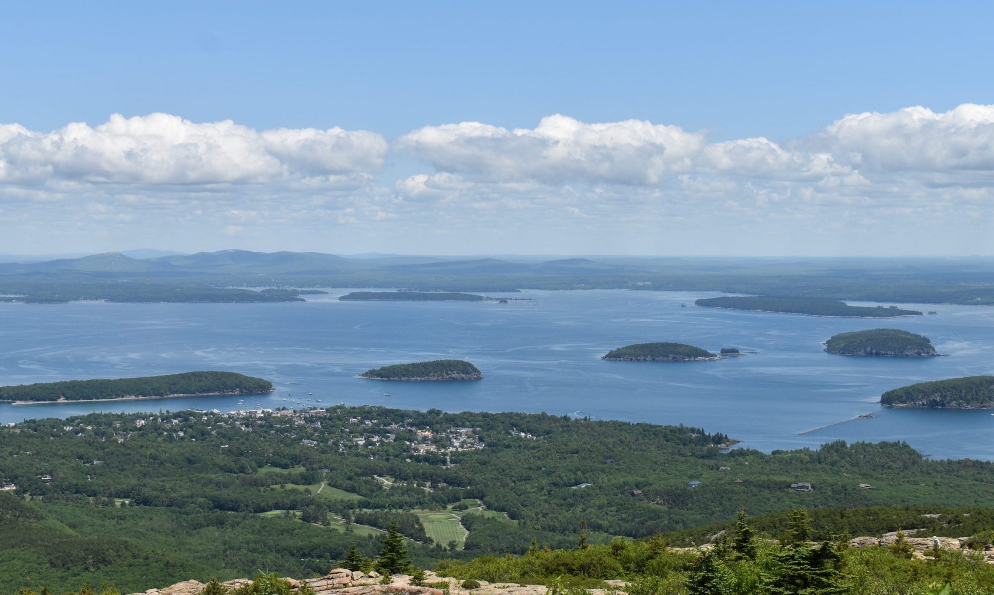
Kebo Mountain Trail is a moderately trafficked trail that is located near Bar Harbor. The trail goes through a spruce forest, and up some stone steps over to Dorr North Ridge Trail where hikers can hike up Dorr Mountain. The Kebo Mountain Trail connects to Kebo Brook Trail, Hemlock Trail, and Dorr North Ridge Trail. The Kebo Mountain Trail is rated a moderate difficulty.

Cadillac North Ridge Trailhead Parking then hike down Kebo Brook Trail until you reach Kebo Mountain Trail.

Check out our archive page to see older versions of this TrailView! An updated TrailView is coming soon to this page.

Trail Stats

Length 0.8 mi
Difficulty Medium
Elevation Gain 400 ft
Elevation Loss 280 ft

Find trails similar to this one by clicking the options below:

See how this trail has evolved over the years by looking at old TrailViews:
How would you rate this trail?

Long Pond Trail (Great Pond Trail)

Long Pond Trail is a moderately hiked trail that is located near Southwest Harbor. The trail starts at the tip of Long Pond and continues one the shore side for 1.7 miles, then the trail goes climbs up a section of the Mansell Mountains. The Long Pond Trail connects to the Perpendicular Trail and the Great Notch Trail. The Long Pond Trail is rated a moderate difficulty.

Parking is at Long Pond Parking Area.

Check out our archive page to see older versions of this TrailView! An updated TrailView is coming soon to this page.

Trail Stats

Length 3.0 mi
Difficulty Medium
Elevation Gain 680 ft
Elevation Loss 250 ft


Find trails similar to this one by clicking the options below:

Difficulty
Elevation Gain

See how this trail has evolved over the years by looking at old TrailViews:

How would you rate this trail?

Ledge Trail

Ledge Trail is located on the Western side of Mount Desert Island and connects to Saint Sauveur Mountain Trail. This trail is dog friendly though it does have steep portions with rocks. This trail is moderately trafficked.

Parking is at Ledge Trailhead parking off of route 102.

Check out our archive page to see older versions of this TrailView! An updated TrailView is coming soon to this page.

Trail Stats

Length 0.5 mi
Difficulty Medium
Elevation Gain 440 ft
Elevation Loss 10 ft

Find trails similar to this one by clicking the options below:

Difficulty
Elevation Gain

See how this trail has evolved over the years by looking at old TrailViews:

How would you rate this trail?

Norumbega Connector Trail

Norumbega Connector Trail is a moderately trafficked trail that is located near Northeast Harbor. The trail is a nice walk through a wooded forest. Norumbega Connector Trail is often hiked in a loop with Norumbega Mountain Trail that goes to the peak of Norumbega Mountain. The Norumbega Connector Trail is rated a moderate difficulty.

Parking is at Norumbega Mountain Pull parking off of State Route 3.

Check out our archive page to see older versions of this TrailView! An updated TrailView is coming soon to this page.

Trail Stats

Length 0.9 mi
Difficulty Medium
Elevation Gain 200 ft
Elevation Loss 140 ft

Find trails similar to this one by clicking the options below:

Difficulty
Elevation Gain

See how this trail has evolved over the years by looking at old TrailViews:

How would you rate this trail?

Norumbega Mountain Trail

Norumbega Mountain Trail is a moderately trafficked trail that is located near Northwest Harbor. The trail is a nice walk through the woods then the tree thins out leading up to Norumbega Mountain Peak giving great views of the park. The Norumbega Mountain Trail connects to the Goat Trail, Golf Course Trail, and Hadlock Pond Trail. The Norumbega Mountain Trail is rated a moderate difficulty.

Parking is at Norumbega Mountain Pull off Parking Area then walk down Goat Trail.

Check out our archive page to see older versions of this TrailView! An updated TrailView is coming soon to this page.

Trail Stats

Length 1.2 mi
Difficulty Medium
Elevation Gain 700 ft
Elevation Loss 60 ft

Find trails similar to this one by clicking the options below:

See how this trail has evolved over the years by looking at old TrailViews:

How would you rate this trail?

Parkman Mountain Trail

Parkman Mountain Trail is a moderately trafficked trail that is located near Northwest Harbor. The trail is a nice wooded hike that brings hikers up to the peak of Parkman Mountain that has great views of the park. Parkman Mountain Trail connects to Hadlock Brook Trail, Hadlock Loop, Upper Mountain Trail, Bald Peak Trail, Parkman Mountain Connector, and Giant Slide Trail. The Parkman Mountain Trail is rated as moderate difficulty.

Parking is at Parkman Mountain Parking Area off of State Route 3.

Check out our archive page to see older versions of this TrailView! An updated TrailView is coming soon to this page.

Trail Stats

Length 1.8 mi
Difficulty Medium
Elevation Gain 750 ft
Elevation Loss 490 ft

Find trails similar to this one by clicking the options below:

See how this trail has evolved over the years by looking at old TrailViews:

How would you rate this trail?

Razorback Trail

Razorback Trail is a moderately trafficked trail that is located next to Long Pond near Southwest Harbor. The trail features a steep hike up to the summit of Mansell Mountain. The Razorback Trail connects to the Great Notch Trail, Bernard Mountain Trail, Mansell-Razorback Connector, and the Gilley Trail. The Razorback Trail is rated as an advanced trail.

Parking is at Gilley Field Parking Area off of Long Pond Road then walk the Cold Brook Trail to get there.

Check out our archive page to see older versions of this TrailView! An updated TrailView is coming soon to this page.

Trail Stats

Length 0.9 mi
Difficulty Medium
Elevation Gain 670 ft
Elevation Loss 210 ft

Find trails similar to this one by clicking the options below:

Difficulty
Elevation Gain

See how this trail has evolved over the years by looking at old TrailViews:

How would you rate this trail?