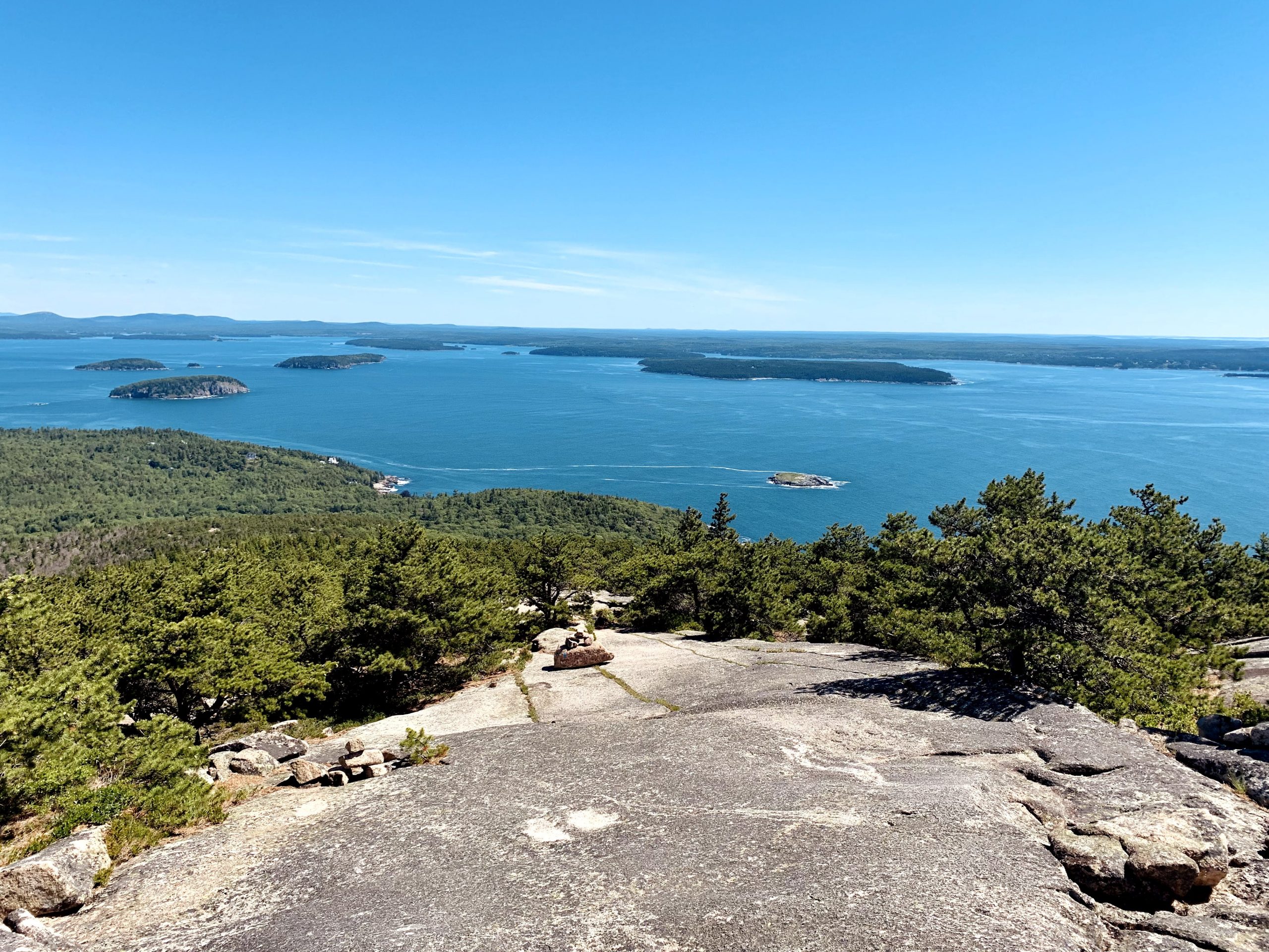
Spring Trail

Spring Trail is a moderately trafficked trail that is located next to Jordan Pond. Spring Trail is a nice wooded trail that brings you through a forest about 0.5 miles below Penobscot Mountain. The Spring Trail connects to the Penobscot Mountain Trail where you can reach the peak of the mountain. Spring Trail connects to Penobscot Mountain Trail, Amphitheater Trail, Jordan Cliff Trail, Asticou & Jordan Pond Path, Jordan Stream Trail, and Jordan Steam Path. The Spring Trail is rated moderate difficulty.

Parking is at Jordan Pond House Parking Area off of Park Loop road.

Check out our archive page to see older versions of this TrailView! An updated TrailView is coming soon to this page.

Trail Stats

Length 0.3 mi
Difficulty Medium
Elevation Gain 140 ft
Elevation Loss 30 ft

Find trails similar to this one by clicking the options below:

Difficulty
Elevation Gain

See how this trail has evolved over the years by looking at old TrailViews:

How would you rate this trail?

Sundew Trail

Sundew Trail is a moderately trafficked trail located on the Schoodic Institute campus. It connects one side to the other as well as offers great views of the ocean on the rocky coast.

Parking at the Schoodic Bunkhouse parking area.

Check out our archive page to see older versions of this TrailView! An updated TrailView is coming soon to this page.

Trail Stats

Length 0.7 mi
Difficulty Easy
Elevation Gain 90 ft
Elevation Loss 70 ft

Find trails similar to this one by clicking the options below:

Difficulty
Elevation Gain

See how this trail has evolved over the years by looking at old TrailViews:

How would you rate this trail?

Stratheden Trail

Stratheden Trail is a moderately trafficked trail. It is dog-friendly and good for all skill types. It connects to hemlock road and Park Loop Road.

Parking at the nature center and take Jesup path to Hemlock Road until Stratheden connects.

Check out our archive page to see older versions of this TrailView! An updated TrailView is coming soon to this page.

Trail Stats

Length 0.7 mi
Difficulty Easy
Elevation Gain 110 ft
Elevation Loss 40 ft

Find trails similar to this one by clicking the options below:

Difficulty
Elevation Gain

See how this trail has evolved over the years by looking at old TrailViews:

How would you rate this trail?

Triad Pass Trail

Triad Pass is a moderately trafficked trail that is located near Seal Harbor. Triad Pass is a short connecting trail that connects the Hunters Brook Trail to Bubbles & Jordan Pond path. This trail is rated a moderate difficulty. 

Parking is at Hunter Brook Trailhead on Dane Farm Road.

Check out our archive page to see older versions of this TrailView! An updated TrailView is coming soon to this page.

Trail Stats

Length 0.1 mi
Difficulty Medium
Elevation Gain 40 ft
Elevation Loss 20 ft

Find trails similar to this one by clicking the options below:

Difficulty
Elevation Gain

See how this trail has evolved over the years by looking at old TrailViews:

How would you rate this trail?

Triad Trail

Triad Trail is a moderately trafficked trail that is located near Seal Harbor. The trail is a nice wooded hike that twists and turns through the Triads. The Triad Trail connects Jordan Pond to Eagle Lake Loop, Hunter Brook Trail, Bubbles & Jordan Pond Path, and Pemetic East Cliff Trail. The Triad Trail is rated a moderate difficulty.

Parking is at Wooded Stables Parking Area off of Park Loop Road then walk down Wildwood Connector.

Check out our archive page to see older versions of this TrailView! An updated TrailView is coming soon to this page.

Trail Stats

Length 0.9 mi
Difficulty Medium
Elevation Gain 470 ft
Elevation Loss 160 ft

Find trails similar to this one by clicking the options below:

See how this trail has evolved over the years by looking at old TrailViews:

How would you rate this trail?

Valley Cove Trail

Valley Cove Trail is a heavily trafficked out and back trail located near Mount Desert. It connects to Valley Cove Road, Flying Mountain Trail, Acadia Mountain Trail, and Man O'War Brook Fire Road. This trail is usually closed during the summer due to Peregrine Falcons nesting in the area.

Parking is located at the Acadia Mountain parking area, on Route 102 near Echo Lake.

This trail is closed yearly from March-August for peregrine falcon nesting season. For this reason, the team cannot provide a TrailView at this time. Please consult alternate resources if you intend to hike the Valley Cove Trail.

Trail Stats

Length 0.9 mi
Difficulty Easy
Elevation Gain 450 ft
Elevation Loss 380 ft

Find trails similar to this one by clicking the options below:

Difficulty
Elevation Gain
How would you rate this trail?

Valley Cove Road

Valley Cove Road is an easy out and back trail near Flying Mountain. It connects to Valley Peak Trail, Acadia Mountain Trail, Man O'War Brook Fire Road, and Flying Mountain Trail.

Parking is available on Fernald Point Road.

Check out our archive page to see older versions of this TrailView! An updated TrailView is coming soon to this page.

Trail Stats

Length 0.5 mi
Difficulty Easy
Elevation Gain 90 ft
Elevation Loss 70 ft

Find trails similar to this one by clicking the options below:

Difficulty
Elevation Gain

See how this trail has evolved over the years by looking at old TrailViews:

How would you rate this trail?

Bubbles Divide

Bubble Divide is a heavily trafficked trail that is located between Jordan Pond and Eagle Lake. The Bubble Divide is used as a connected trail to get between Jordan Pond and Eagle Pond. The Bubble Divide connects to Jordan Pond Path, Bubbles Trail, and Jordan Pond Carry.

Parking is at Bubble Mountain Trailhead Parking Area off of Park Loop road.

Loading...

Trail Stats

Difficulty Medium
Length 0.3 mi
Elevation Gain 360 ft
Elevation Loss 20 ft

Find trails similar to this one by clicking the options below:

See how this trail has evolved over the years by looking at old TrailViews:

Find trails similar to this one by clicking the options below:

How would you rate this trail?

Cadillac Cliffs Trail

Cadillac Cliffs Trail is a heavily trafficked trail that is located near Bar Harbor. The trail follows a granite wall along cliffs and goes by a sea cave. Hikers will have to use iron rungs to reconnect out of the Cadillac Cliffs trail to Gorham Mountain Trail.

Parking is at Gorham trailhead Parking Area off of Park Loop Road.

Check out our archive page to see older versions of this TrailView! An updated TrailView is coming soon to this page.

Trail Stats

Length 0.3 mi
Difficulty Hard
Elevation Gain 190 ft
Elevation Loss 60 ft

Find trails similar to this one by clicking the options below:

Difficulty
Elevation Gain

See how this trail has evolved over the years by looking at old TrailViews:

How would you rate this trail?

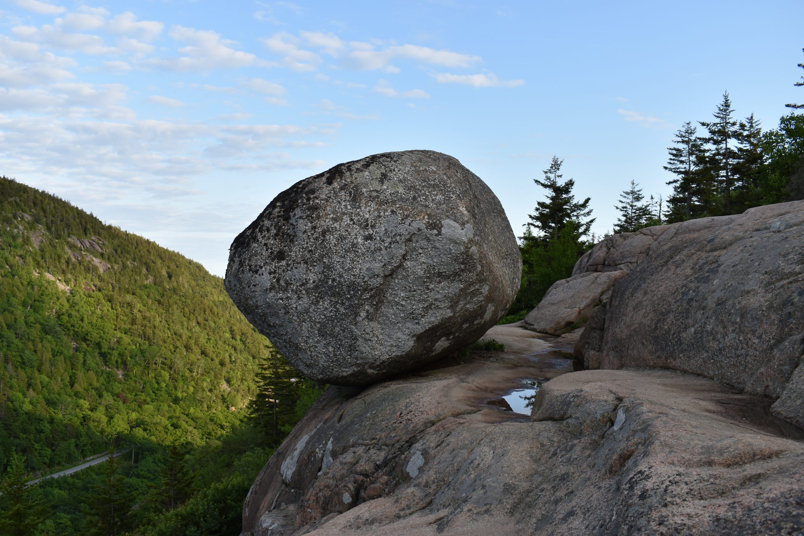
Champlain North Ridge Trail

Champlain North Ridge Trail is a moderately trafficked trail that is located near Bar Harbor. The trail takes you to a wooded forest then ascends up to Champlain Mountain. The Champlain North Ridge Trail connects to Orange & Black Path, Beachcroft Path, Precipice Trail, and Champlain South Ridge Trail. The Champlain North Ridge Trail is rated moderate difficulty.

Parking is at Champlain North Ridge Parking Area off of Park Loop Road.

Loading...

Trail Stats

Length 1.0 mi
Difficulty Medium
Elevation Gain 890 ft
Elevation Loss 20 ft

Find trails similar to this one by clicking the options below:

See how this trail has evolved over the years by looking at old TrailViews:
How would you rate this trail?